
Annapurna Circuit Trek Map
This is a dedicated page for Annapurna Circuit Trek Map, representing the updated, quality-assured, and attractive route map. We have created this page for your simplicity and practicality and to enhance your trekking experience. It shows an accurate overview of the trip with just enough information. With the detailed trail route of Annapurna Circuit Trek, the map serves as a compass for the trek.
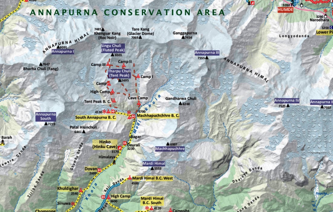
The map contains standard sets of icons, differently shaped and colored symbols that are the graphical representation of information and represents features like International Boundary, National Park Boundary, Highway, Main Road, Main Trekking Route, Secondary Trekking Route, Peaks, Temple, Monastery, Chorten, Airport, Helipad, Glacier, Rivers, Check Point and many more. In addition, this map shares the feature of zoom in and zoom out. Click on the plus button to zoom in and the minus button to zoom out.
Annapurna Circuit Trek is one of the finest treks in Nepal, popular for scenery and cultural diversity. The dramatic desert-like landscape, high pass of Thorong La, Marsyangdi Valley, Tilicho Lake, Ice Lake, and stunning views of the 8,000 meters peaks are some of the stunning attractions of the trek. The picturesque mountain villages and the warm local hospitality are the cherries on top.
The trail starts from Manang, a beautiful and prominent landmark in the Annapurna region. For every trekker, Manang is the acclimatization stop to acclimatize to the high altitude. There are no motorable roads to Manang; you can take a jeep from Kathmandu to Manang. Trekkers who are pressed for time opt for this alternative. The black dashed line enclosed by yellow color represents the main trekking route. Follow through the line, and you can see stopping points of the trek.
The map scale of this map is 1: 200,000. It means one inch of the map equals 200,000 inches of real-world terrain. For your information, the H letter enclosed in pink color in the map represents Hotel/inn along the route; the H letter enclosed in blue color represents Health Post. You can easily identify the symbols for peaks, campsite, temple, monastery, airport, helipad, World Heritage Site, river, and bridges.


